
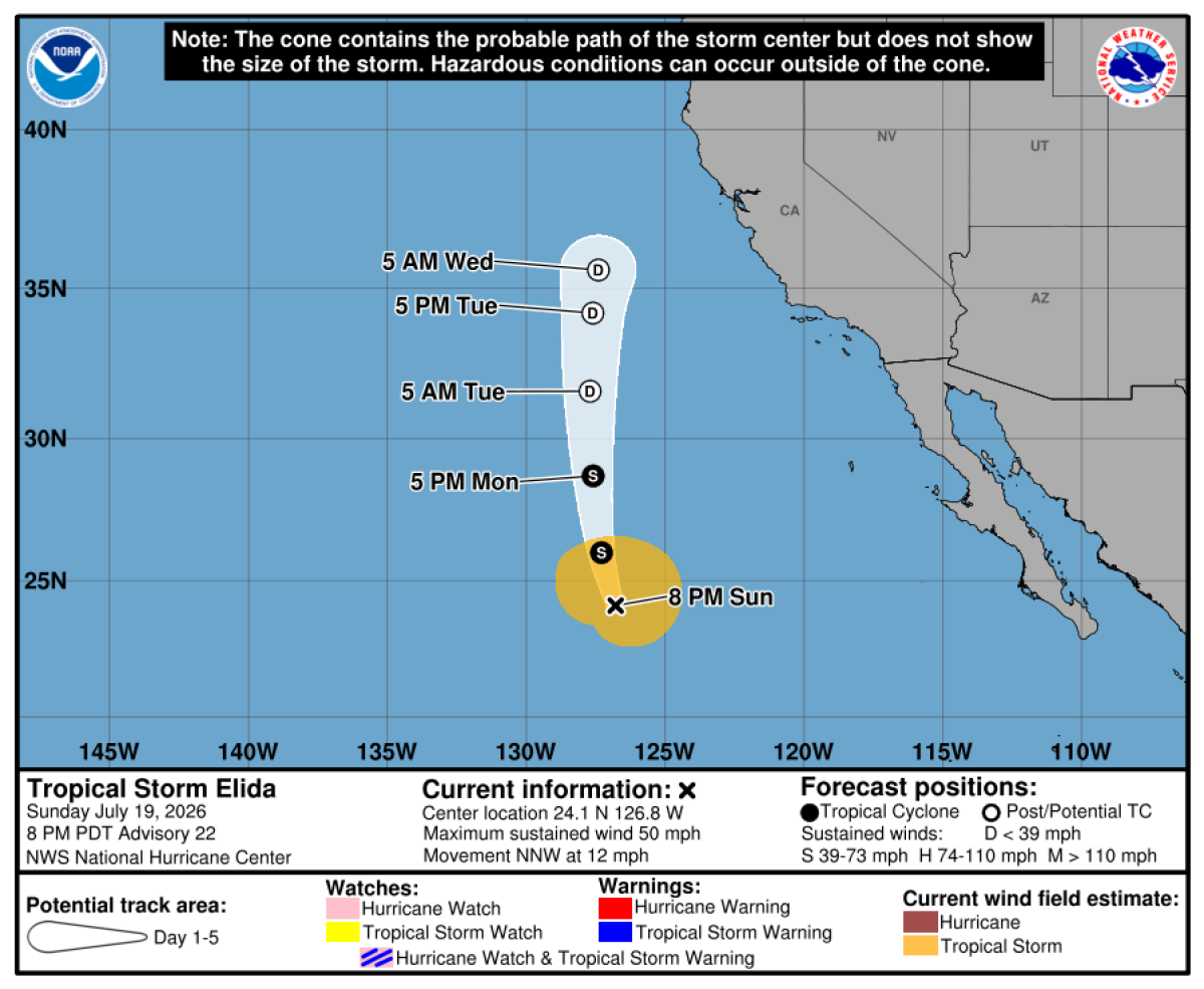
Southern California is experiencing two severe weather threats this week: a dangerous heat wave and hazardous high waves along the coast. High pressure moving in from the east, coupled with the unusual path of Tropical Storm Elida, is responsible for these conditions.
Heat Wave Impacts
The high heat began on Tuesday and is expected to continue for seven days. The National Weather Service (NWS) in Oxnard has warned of a ‘major heat risk’ by the weekend. Inland Empire, inland Orange County, San Diego County valleys, as well as desert and mountain areas, are all affected. On Wednesday, temperatures could soar to 105 degrees in Lancaster, 103 in Canoga Park, 98 in Santa Clarita, 95 in Covina, 89 in downtown Los Angeles, 86 in Santa Barbara and Thousand Oaks, and 85 in Long Beach. Later this week, areas in the Inland Empire and San Diego Valley interiors might surpass 100 degrees, with desert regions exceeding 110 degrees, according to meteorologist Sebastian Westerink from the NWS San Diego office.
Fire Weather Concerns
Starting Tuesday and continuing through Monday, meteorologists have issued a warning for potential critical fire weather conditions in interior areas. Weak-to-moderate sundowner winds could affect southwestern Santa Barbara County in the late afternoons and evenings from Tuesday to Thursday. These warm winds can quickly spread fires if ignited, as they come down from the southern slopes of the Santa Ynez Mountains.
Coastal Hazards
Heading to the beach could prove risky due to dangerous surf from Tropical Storm Elida, originating off southern Mexico. Elida has taken a northern path, bringing high surf particularly to south-facing beaches. Beachgoers could encounter waves 4 to 8 feet high, while Orange County is already experiencing waves of 4 to 6 feet, with some reaching up to 8 feet. Westerink noted these conditions are expected to persist at least through Tuesday, while Tropical Storm Fausto might cause another set of elevated swells later in the week.
Tropical Storms and Moisture
Elida is expected to remain offshore, but a plume of moisture from the storm already arrived in the San Francisco Bay Area on Sunday. This may bring light rain and isolated lightning, especially Monday morning and Tuesday night into Wednesday. Meteorologist Rachel Kennedy from the Monterey office mentioned that Elida should weaken as it moves north into cooler waters, with only remnants moving forward.
Maritime Heat and Humidity
The storm has contributed to an uptick in humidity in Los Angeles and San Francisco Bay areas. Westerink explained that ongoing marine heat waves off Southern California, reported by NOAA, are causing higher sea surface temperatures that influence the air temperature and humidity, making conditions muggy.
Heat Wave Causes and Precautions
The heat wave is driven by a massive ridge of high pressure over Utah and Wyoming extending to the southwest, detailed Carol Ciliberti from the NWS Oxnard office. High pressure causes cooler air to compress, warm, and dry out. Residents are advised to avoid outdoor work during peak heat, take frequent breaks in shade, stay in air-conditioned places, and ensure pets and children are not left in parked cars.
Record-Breaking Heat
California, alongside several other western states, is enduring extraordinary heat, breaking previous records for the January-June period. Climate scientist Zachary Labe highlights that human-caused climate change is a primary driver of these record temperatures.