
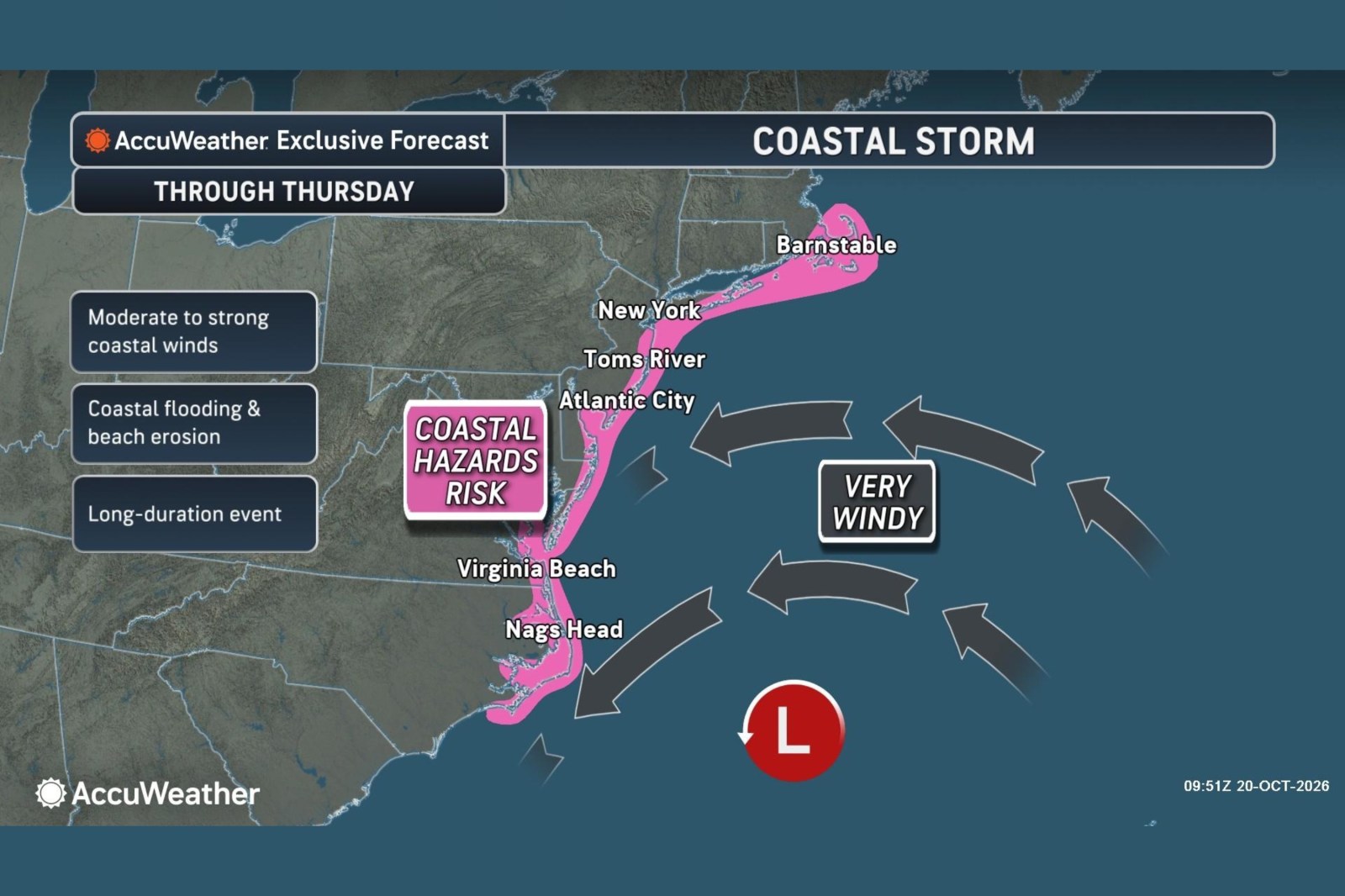
A nor’easter is advancing slowly along the East Coast, posing a threat of strong winds, coastal flooding, dangerous surf, and beach erosion. This weather system could affect multiple states through Thursday.
Forecast data shared with Newsweek reflects a risk zone stretching from North Carolina to Massachusetts. This area is susceptible to moderate to strong winds alongside coastal flooding and the erosion of beaches. The storm is predicted to gradually move northward offshore. Forecasters from AccuWeather suggest it might develop tropical or subtropical characteristics while traversing over the warm Gulf Stream waters.
The National Weather Service (NWS) issued coastal flood warnings as of Tuesday for regions in New Jersey, Delaware, Maryland and Virginia.
What Forecasts Say
AccuWeather reports that the storm’s center will shift from the waters off the Carolinas towards the mid-Atlantic, southern New York, and New England. This movement will spread coastal hazards further north by the end of the week. Most of the storm’s moisture is anticipated to remain offshore, significantly impacting coastal areas, while many inland zones are likely to stay dry.
According to AccuWeather, the most intense winds from Morehead City, North Carolina, to Atlantic City, New Jersey, were likely through Tuesday. Wind gusts in these regions could hit between 40 and 60 mph, with an isolated peak of 70 mph possible. Breezy conditions are expected to develop further north later in the week along the rest of coastal New Jersey, Long Island, southern Rhode Island, and Cape Cod in Massachusetts.
Fox Weather predicts several days of hazardous conditions, emphasizing that the most severe impacts will continue through late Wednesday into Thursday. They highlight the most significant flooding threat from the Outer Banks through Chesapeake Bay, extending toward Ocean City, Maryland, where water levels could exceed 2 feet above normal during high tide.
Meteorologists also note the potential for the system to briefly transform into a subtropical or tropical storm.
“AccuWeather assigns the area of low pressure off the East Coast a moderate chance of developing tropical or subtropical characteristics in the upcoming days,” Alex DaSilva, AccuWeather’s lead hurricane expert, informed Newsweek. “While a subtropical transition is more probable, a fully tropical system can’t be ruled out. If the storm becomes subtropical, the National Hurricane Center can assign it a name.”
DaSilva elaborated that tropical systems derive energy from warm ocean waters, whereas subtropical systems utilize both warm waters and the jet stream for energy.
“Nor’easters in October attempting to gain tropical or subtropical features are not uncommon,” he stated. “A recent nor’easter came close to achieving this transition. The Gulf Stream’s water temperatures remain warm at this time of year, providing significant energy to these storms.”
Regardless of any development, the mid-Atlantic coast could experience coastal flooding, dangerous surf, and beach erosion this week.
What Is a Nor’easter?
The NWS describes a nor’easter as a type of storm affecting the East Coast of North America, characterized by northeast winds over coastal regions. While they can occur any time of year, these storms are most frequent and intense between September and April.
Contact Newsweek editors on this story: Matthew Robinson and Dave Siminoff.