
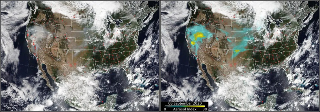
As wildfires escalate globally, researchers have launched an airborne mission to investigate the pyrocumulonimbus (pyroCb) clouds that form over severe blazes. These ‘firestorm’ clouds can project smoke into the stratosphere as powerfully as volcanic eruptions, causing extreme weather events like lightning and firenadoes. Their unpredictability poses risks to residents and emergency crews.
This summer, a team led by NASA, the U.S. Naval Research Laboratory (NRL), and the National Center for Atmospheric Research (NCAR) flew aircraft over wildfire smoke plumes to collect real-time data. The mission, known as INSPYRE (Injected Smoke and Pyrocumulonimbus Experiment), sought to understand these clouds and their atmospheric effects. As John Yorks from NASA’s Goddard Space Flight Center noted, they gained insights never obtained before by sampling inside plumes and clouds.
David Peterson, a meteorologist at NRL, described the mission as an organized storm chase of wildfires. The first deployment was a success, allowing the team to even sample cloud tops. Peterson recounted the ‘unworldly experience,’ noting the smoke’s impact on visibility and smell.
Understanding pyrocumulonimbus clouds is vital. These clouds can create hazardous weather, including dry lightning that ignites new fires and strong winds that complicate firefighter efforts. With wildfires more frequent in places like North America and Australia, and even emerging in Europe, this knowledge aids forecasting and safety.
Formation of Firestorm Clouds
Firestorms develop when wildfires, fueled by hot, dry, and windy conditions, produce dense smoke plumes. These plumes carry water vapor and smoke particles high into the atmosphere, condensing into a pyrocumulonimbus cloud. According to Michael Fromm of NRL, these clouds act like giant chimneys, elevating smoke high into the atmosphere, creating unpredictable ground conditions.
The phenomenon is becoming more common, with France recording its first pyroCb cloud in July. Major events, like Australia’s Black Summer of 2019-2020, resulted in massive smoke plumes comparable to volcanic eruptions, highlighting the need for better predictions.
INSPYRE Mission Insights
Firestorm clouds present mysteries, challenging researchers’ ability to model them accurately. Yorks mentioned that the field is young, with only 15-20 years of study. Understanding cloud formation and connection to meteorological conditions remains critical for forecasting.
INSPYRE builds on prior efforts, aiming to close gaps in satellite observations. Ziming Ke of the Desert Research Institute highlighted the importance of understanding aerosols within clouds. This knowledge could improve predictions of lightning and other weather phenomena.
Tracking smoke’s journey through pyroCb clouds can reveal significant insights. Peterson emphasized the importance of identifying which fires produce pyroCbs to forecast their impact on atmospheric layers.
The mission aims to study black carbon’s role in these clouds. Anne Perring from Colgate University explained that understanding how much black carbon is involved will inform atmospheric chemistry research.
Experiencing the Firestorm from Above
Throughout the Western U.S. wildfire season, INSPYRE tracked smoke plumes with coordinated ground and air efforts. NASA’s Earth Resources-2 plane collected data from above the clouds, while NCAR’s Gulfstream V sampled air within the smoke.
These direct observations enable researchers to build a vertical profile of firestorms, which is crucial for improved forecasting. Ke believes the findings will benefit the wider research community.
The team pursued a Siberian firestorm plume reaching Idaho, amassing comprehensive data. Peterson expressed confidence that this year’s findings will advance understanding and improve future weather models.
As data analysis begins, the team is preparing to refine and extend their research with more deployments next year.
A free press is essential for democracy. Support reliable journalism and open dialogue.