
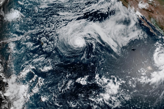
Hurricane Genevieve, a major force in the Pacific Ocean, was situated far from land on Monday evening. It coincided with the weakening of Tropical Storm Fausto, which delivered substantial waves to Hawaii.
Earlier on Monday, Genevieve briefly reached Category 5 hurricane status. This marked the first occurrence of such an intense hurricane in the East Pacific region in two years, as reported by the National Hurricane Center. The hurricane was expected to remain distant, maintaining a trajectory roughly parallel to the Mexican coast.
The National Hurricane Center in Miami noted that Genevieve had maximum sustained winds of 145 mph (230 kph). The hurricane’s center was approximately 505 miles (810 kilometers) southwest of the southern tip of the Baja California peninsula, advancing northwest at a rate of 12 mph (19 kph).
There were no coastal watches or warnings at that time. However, the center indicated that swells generated by Genevieve were impacting parts of Mexico’s southwestern coastline and the Baja California peninsula. These swells could cause hazardous surf and rip current conditions.
Genevieve was projected to fluctuate in strength before gradually weakening later in the week.
To the northwest in the Pacific Ocean, Hurricane Fausto had decreased in intensity to a tropical storm by Monday evening. It continued moving in the general direction of the Hawaiian Islands. Weather experts predicted that Fausto would pass north of Hawaii, yet they advised residents to monitor the storm’s progress closely.
The hurricane center indicated that substantial surf and strong currents were affecting east-facing shores throughout Hawaii’s islands. Fausto registered maximum sustained winds of 70 mph (110 kph). The storm was centered approximately 415 miles (670 kilometers) east-northeast of Hilo, Hawaii, traveling west-northwest at 16 mph (26 kph).