
Coastal Damage Assessment in Southern California
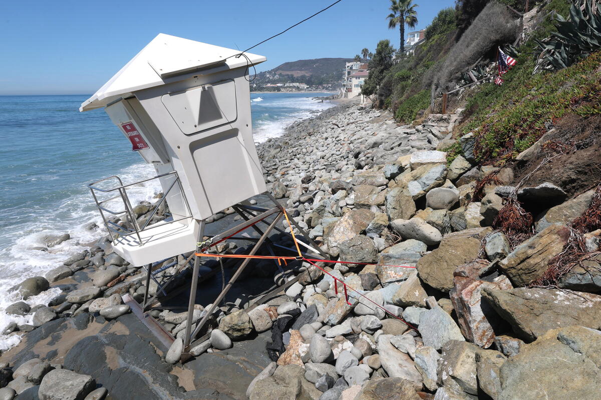
Coastal communities in Southern California are surveying damage caused by waves and flooding. This comes as Southern California prepares for potential destruction from a ‘coastally trapped Kelvin wave.’ Areas, including homes from south Orange County to Malibu, have been severely impacted by flooding and damage. Coastal erosion has significantly affected the coast between Carlsbad and Long Beach.
Laguna Beach, Dana Point, and Carlsbad recently declared a local state of emergency. This was due to beach erosion and sand loss, caused by a south swell from Hurricane Marie. A pattern known as El Niño often leads to active hurricane seasons in the eastern Pacific, which is where Hurricane Marie originated.
“I’d been chatting with other cities and city managers up and down the coast, and I think we all had different levels of damage,” Laguna Beach City Manager Dave Kiff said. “I think Laguna’s was among the greatest, or most significant, but everybody talked about concern about sand and sand replenishment.”
Emergency measures are being taken by Orange County, including activation of their emergency operations center. This action is required when two cities in the county declare a local emergency.
“Our coastal cities are experiencing serious damage, and the county is mobilizing our emergency response,” Orange County Board of Supervisors Vice Chair Katrina Foley stated.
Potential Risks from Coastally Trapped Kelvin Wave
A ‘coastally trapped Kelvin wave’ is expected to reach the U.S. West Coast soon, traveling from the coast of Mexico. Government experts suggest a significant El Niño event could prompt severe storms, with a 75% chance of it being the most intense since 1950.
Understanding Kelvin Waves
Kelvin waves play a crucial role in El Niño events. These waves arise from warm ocean water movements in the central and eastern equatorial Pacific, altering the atmosphere, thus impacting global weather.
Researchers have learned that coastally trapped Kelvin waves, discovered decades ago, must navigate a coastal boundary following the Northern Hemisphere’s shoreline. Understanding these waves has improved as scientific models now track their real-time progression, further exemplified by current developments in El Niño.
“Now scientists have a way of seeing these things unfold in real time,” Dillon Amaya, an oceanography expert, explains.
Projected Impacts from Rising Sea Levels
When Kelvin waves become coastally trapped, they raise sea levels and ocean temperatures, submerging cold, nutrient-rich waters. Sea levels may temporarily rise by 6 to 12 inches, significantly increasing flooding risks, particularly during storms and high tides.
“Those elevated sea levels, when combined with passing weather or storms, can substantially increase flood risk,” Amaya noted.
Predicted Wave Arrival on U.S. Coast
The Kelvin wave is nearing Mexico’s west coast and is expected to enter the Gulf of California soon. It will take about two to three weeks to travel to and through Southern California and reach San Francisco.
“They travel something like 25,000 kilometers [15,500 miles] all the way from the western equatorial Pacific up … to the Gulf of Alaska,” Amaya described.
Long-Term Coastal Impact
The impending wave won’t be noticeable to individuals in the water, but it will raise sea levels near California by 6 inches. This could extend the already visible damage along the California coast, particularly during storm surges.
The state has witnessed a foot of sea level rise over the last 125 years due to climate change and polar ice melt. During these times, elevated sea levels threaten the coastline more than before, especially when coupled with extreme weather conditions.
“When the water level is extra high, a foot or more higher than we expect it to be, then it can really wreak havoc,” Jonathan Warrick, USGS research geologist, stated.