
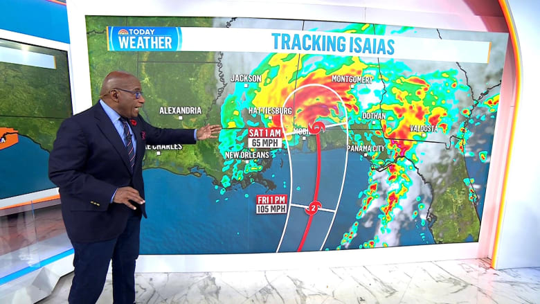
Storm Tracker: Hurricane Isaias
Hurricane Isaias is making its way toward the Gulf Coast with expectations of heavy impacts. Storm surge, flooding, and possible tornadoes are among the potential threats as the hurricane makes landfall.
Storm Surge Totals:
- Ocean Springs, MS, to Indian Pass, FL: 5-7 feet
- Mobile Bay, AL: 5-7 feet
- Mouth of the Mississippi River, LA, to Ocean Springs, MS: 5 feet
- Indian Pass, FL, to Steinhatchee River, FL: 4-6 feet
- Steinhatchee River, FL, to Yankeetown, FL: 2-4 feet
- Lake Pontchartrain, LA: 1-3 feet
Expected rainfall includes 3-7 inches from southeastern Louisiana to the western Florida Panhandle, with some areas locally reaching up to 10 inches. The Southeast, TN Valley, and the Carolinas may see 1-3 inches, while Washington to New York City can anticipate 1-2 inches.
Possible Tornadoes:
- Isolated tornadoes may occur Friday night in coastal Alabama, the Florida Panhandle, and far southwestern Georgia.
- Saturday, the risk continues for eastern Alabama, Georgia, and northern Florida.
- Isaias could produce multiple tornadoes if risk levels increase.
What to Expect from Hurricane Isaias
Isaias has intensified to an 80 mph Category 1 hurricane. Currently located 385 miles south-southwest of the Mississippi River mouth, it is moving east-northeast at 9 mph. There are storm surge warnings and hurricane warnings for the northern Gulf Coast.
Hurricane-force winds extend 15 miles from the center, and tropical storm-force winds reach 90 miles. The forecast suggests Isaias might become a Category 2 hurricane early tomorrow and make landfall late tomorrow night or early Saturday near Pensacola.
Wind and Inland Impact:
- Fast-moving hurricane increases inland wind risk.
- Potential tree damage and power outages through Alabama and Tennessee.
- Models indicate a rapid improvement in conditions as the storm moves away.
Isaias Strengthens into Category 1 Hurricane
Currently, Isaias is 420 miles south-southwest of Mississippi, moving northeast at 9 mph with 80 mph winds. Hurricane watches and warnings are from Panama City to Biloxi. The storm could escalate to a Category 2 by tomorrow and make landfall late Friday into Saturday morning with 65 mph winds. There’s a chance it reaches Category 3 on Friday.
Storm surges between 3 to 7 feet are a concern. Floods could exceed 10 feet in certain areas with battering waves likely eroding beaches. Wind speeds may cause significant damage, while the tornado threat extends to areas like Columbus, Georgia.
Oil and Gas Production Halts
As the storm approaches, key oil and gas operations in the Gulf are shut down, affecting roughly 25% of production temporarily. About 511,000 barrels daily are off the market, impacting oil prices. Evacuations have occurred on eight of 371 oil platforms.
Jim Burkhard from S&P Global Energy notes the market risk is moderate, but increasing amidst Isaias potentially striking near refineries.
Beyond Winds: Additional Threats
States of emergency are declared in Alabama and Florida. Alongside winds, Isaias may bring tornadoes, large waves, and storm surge. Hurricane watches are in place from Bay St. Louis, MS to Indian Pass, FL. Panama City Beach prepares for impact by removing lifeguard towers.
Rainfall predictions include widespread totals of 3 to 7 inches up to 10 inches from Mississippi to the Florida Panhandle. Heavy rain bands might spread inland across the Southeast, Appalachians, and Mid-Atlantic over the weekend.