
Hurricane Karina has intensified into a Category 4 storm in the eastern Pacific. The National Hurricane Center (NHC) reports that swells generated by Karina will move north, affecting Southern California beaches with potentially hazardous surf and rip currents.
NOAA Advisory: NOAA’s NHC states, “Swells generated by Karina will affect parts of southwest Mexico and the Baja California Peninsula for several days. These swells may spread to Southern California from Monday through midweek, causing life-threatening surf and rip conditions.” While Karina itself is not forecast to approach California, the swells pose the primary threat.
Karina is currently located approximately 1,020 miles west-southwest of Baja California’s southern tip, with sustained winds of 145 mph, moving westward at 9 mph. No coastal watches or warnings are currently in effect.
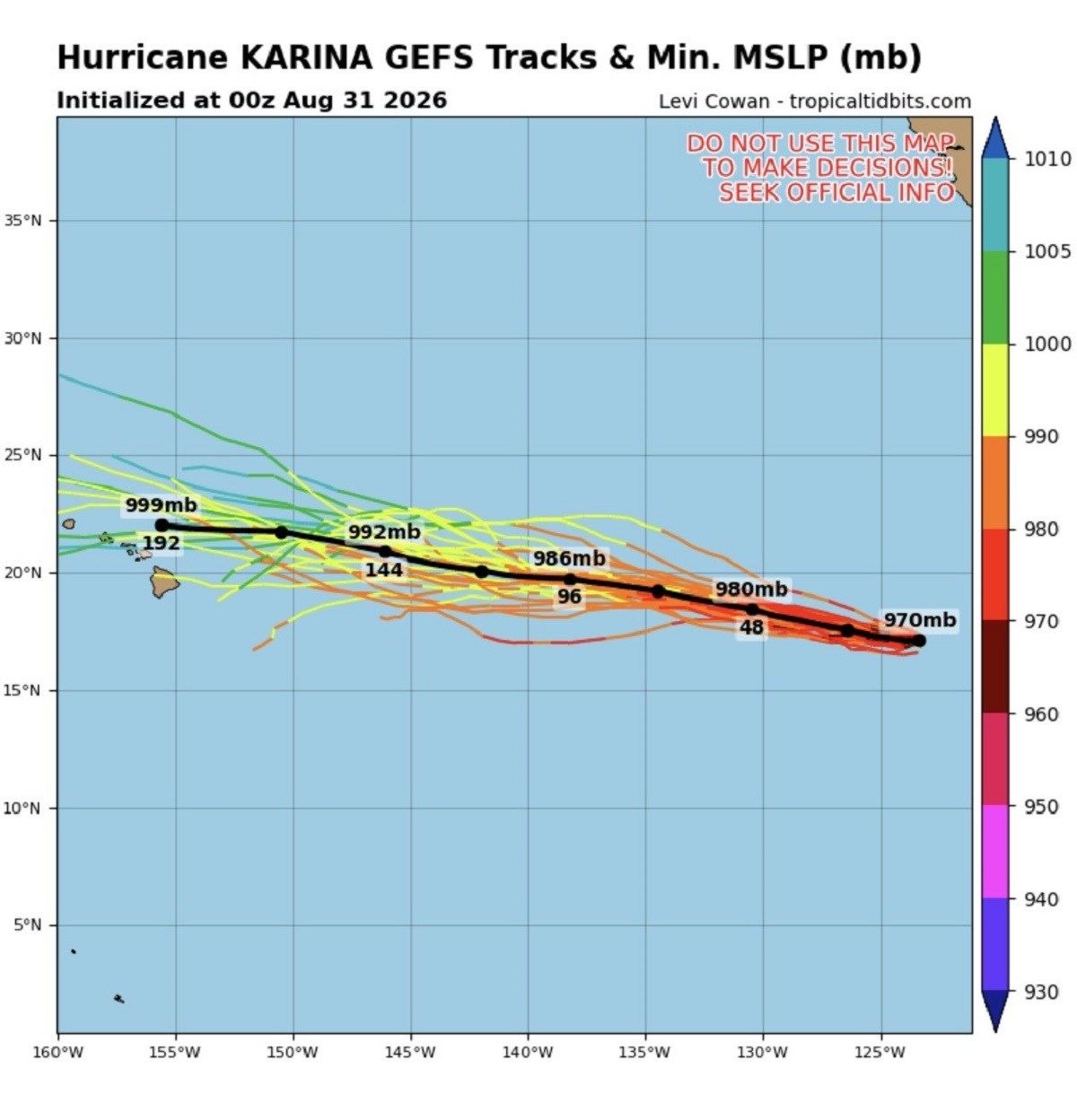
Spaghetti Model Guidance: Data from Tropical Tidbits shows Karina’s predicted path over the open Pacific, remaining offshore from Mexico and California. Various meteorological acronyms in these forecasts include:
- GEFS: Global Ensemble Forecast System, presenting a range of possible storm tracks.
- Track: Predicted paths of the storm’s center.
- MSLP: Minimum mean sea level pressure, a lower value indicates stronger storms.
- Mb and hPa: Units of atmospheric pressure measurement.
The models show the storm moving westward, keeping its center away from land.
Forecast Developments: The NHC predicts Karina’s continued westward movement on Monday, then west-northwest by Tuesday, remaining in the Pacific. Swells will impact Southwest Mexico and Baja California, spreading toward Southern California beaches. Beachgoers should expect dangerous surf and rip currents.
Checking Beach Conditions: Visitors to Southern California beaches should seek the latest forecasts and warnings concerning surf and rip current risks. The NHC advises checking local weather-office updates.