Significant Snowfall Expected in Montana and Wyoming
A late-season winter storm is predicted to bring substantial snow to Montana and Wyoming. Forecasters caution that mountainous regions might receive over a foot of snow by Thursday.
Though snow at high altitudes in May is usual, the current storm’s timing and strength highlight the lasting winter effects into late spring. Such heavy snowfall can disrupt travel in mountain routes frequently used by recreational visitors. Early-season outdoor activities and local economies could also be affected.
Moreover, accumulating snow with fluctuating temperatures can create unstable conditions in high terrains, possibly raising avalanche risks and delaying runoff impacts later.
Warnings Issued by the National Weather Service
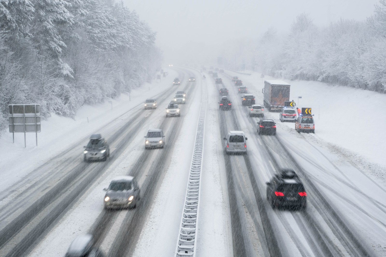
The National Weather Service (NWS) in Billings has issued relevant warnings. A winter storm warning covers areas in southern Montana, while a winter weather advisory extends across parts of both states. Some locations might witness snow accumulation reaching up to 13 inches, coupled with strong winds reducing visibility.
Details of Montana Winter Storm Warning
A winter storm warning is active from 6 p.m. Wednesday to 6 p.m. MDT Thursday for the Absaroka and Beartooth Mountains, including Cooke City. North-facing slopes above 7,000 feet will see the heaviest snow.
Total accumulation is estimated at 8 to 13 inches, with winds gusting up to 30 mph. The NWS advises that recreational activities in mountainous areas are likely to be disrupted.
Travelers are recommended to carry emergency supplies such as food, water, and a flashlight due to potential worsening conditions.
Weather animation on windy.com shows where the most intense snow is expected over the coming days.
Wyoming Winter Weather Advisory
A weather advisory is issued from 3 a.m. to 9 p.m. MDT Thursday for the Pryor/Northern Bighorn Mountains in Montana and Northeast Bighorn Mountains in Wyoming, including Burgess Junction and Story.
Snow accumulation is expected between 5 to 10 inches, with gusts reaching up to 30 mph. Travel conditions might become challenging during morning and evening hours.
U.S. Route 14 and other roads likely to become slippery. Officials urge drivers to slow down and remain cautious.
Authorities suggest checking road conditions before travel, while staying updated on forecasts as the storm continues.
Thunderstorms and Rain Forecasted
Lower elevations might encounter thunderstorms and rain with a cold front passing through. The NWS Billings noted on X that these thunderstorms might bring gusty winds, small hail, and brief downpours.
Cold Weather in Great Lakes Region
Meanwhile, frost advisories and freeze warnings are issued in the Great Lakes region. Northeast Minnesota, northern Wisconsin, and northern Michigan, including the Upper Peninsula, are under advisories, with freeze warnings in Michigan.
Windy.com temperature animations illustrate the cold sweep across the region.
Safety Measures During the Storm
Both alerts are expected to expire by Thursday night. During the snowstorm, residents and visitors should:
- Stay informed: Regularly check NWS updates and state DOT road conditions.
- Adjust driving: Significantly reduce speed, as spring tires don’t grip as effectively as winter tires in mountain slush.
- Pack essentials: Carry waterproof layers, heavy thermal gear, and an emergency kit if traveling backcountry.