
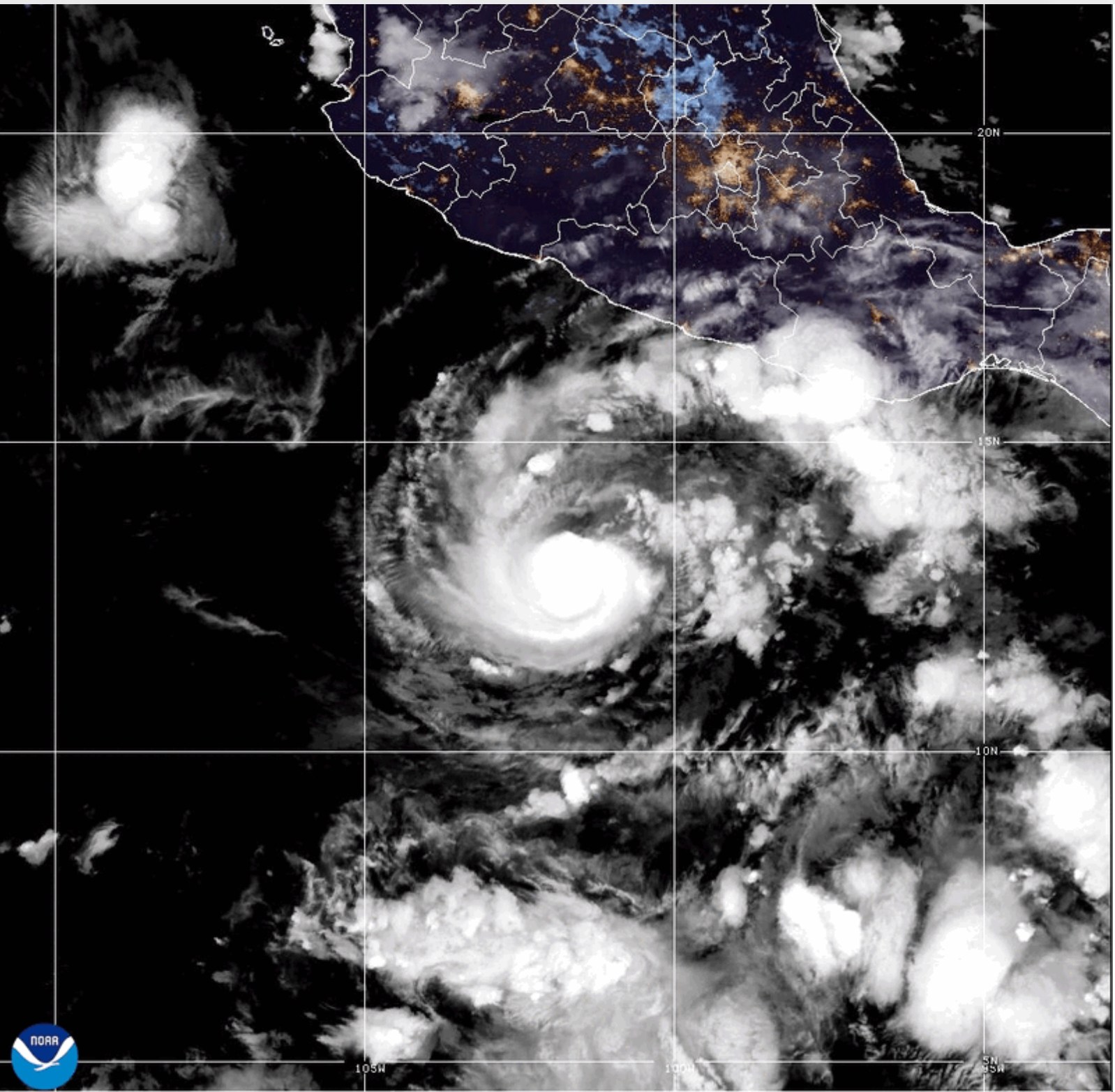
Hurricane Trudy’s Impact on Mexico
Hurricane Trudy persisted in bringing heavy rain and gusty winds to southwestern and west-central Mexico on Sunday. Forecasters have issued warnings about potential life-threatening flooding and mudslides in regions with steep terrain.
At 8 a.m. MST Sunday, Trudy’s maximum sustained winds reached 105 mph. The storm was centered approximately 115 miles southwest of Cabo Corrientes and 165 miles west of Manzanillo, according to the National Hurricane Center (NHC).
The hurricane moved northwest at 8 mph, with expectations of producing additional rainfall of 2 to 6 inches. Isolated storm totals might reach 12 inches along the southwest Mexican coast in Jalisco.
Anticipated Hazards
Trudy’s center was predicted to begin moving away from mainland Mexico on Sunday afternoon. However, rain, winds, and coastal hazards were anticipated to continue affecting parts of the country.
The NHC highlighted the likelihood of a dangerous storm surge with damaging waves where winds blew onshore. Hurricane-generated swells were also expected to cause life-threatening surf and rip currents along southwestern and west-central Mexico.
Hurricane-force winds extended up to 30 miles from the center. Tropical-storm-force winds extended up to 105 miles.
Preparedness and Warnings
Mexico’s Navy announced closures in Puerto Vallarta, Manzanillo, Lázaro Cárdenas, and Puerto Escondido due to Trudy, restricting all navigation. Several other ports were closed to small vessels.
Authorities advised the maritime community and coastal residents to take extreme precautions due to high surf, intense rain, and risks of swollen rivers, flooding, and landslides.
El Niño’s Influence
The contrast between the Atlantic and Pacific hurricane seasons of 2026 is evident, influenced by El Niño. This phenomenon typically suppresses Atlantic hurricanes through increased wind shear while favoring tropical cyclone activity in the eastern Pacific.
Ongoing Threats in Mexico
A tropical storm warning was active from Playa Perula to San Blas and for Las Islas Marías. The Mexican government downgraded the hurricane warning between Playa Perula and Cabo Corrientes and removed all warnings south of Playa Perula.
The NHC stated that tropical-storm conditions were expected along the warned portion of mainland Mexico Sunday morning and in Las Islas Marías during the afternoon.
Trudy’s outer bands were anticipated to produce an additional 1 to 2 inches of rain, with isolated totals near 4 inches along the coast in northern Colima and southern Nayarit. The rainfall might lead to localized flash flooding in areas with steep terrain.
On Sunday night, Trudy was forecasted to turn west-northwest and pass south of Baja California Sur on Monday and Tuesday. Rapid weakening might begin tonight, potentially degenerating Trudy into a post-tropical low by Tuesday night.
Quiet Atlantic Season
As Trudy menaces Mexico in the eastern Pacific, the Atlantic basin remains unusually quiet. September 10 is typically the peak of Atlantic hurricane activity. However, only one of the nine named storms in 2026, Isaias, strengthened into a hurricane by October 18.
NHC data revealed the season is five hurricanes below the 1991-2020 average. The accumulated cyclone energy is 83 percent below normal, highlighting the limited Atlantic hurricane activity this year.