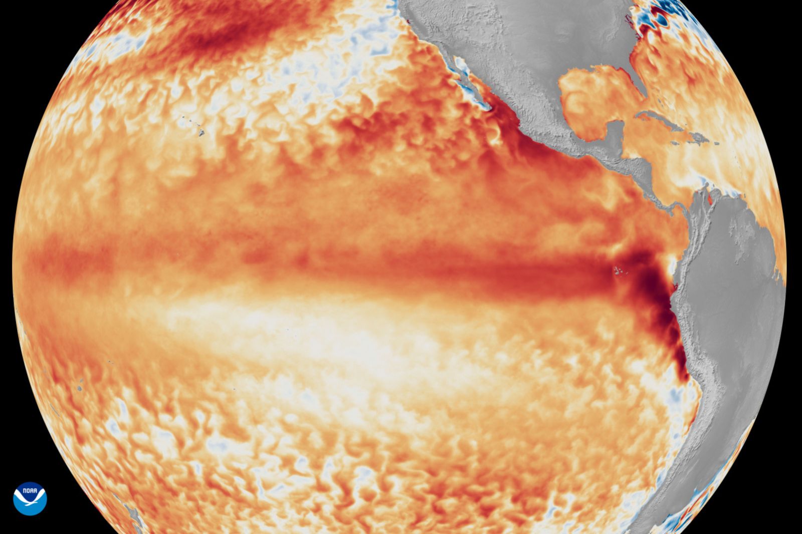
Formation and Future of El Niño
The El Niño climate pattern has taken shape in the tropical Pacific. Australia’s Bureau of Meteorology warned it might become one of the most powerful events in 70 years. This climate phenomenon is marked by unusually warm sea-surface temperatures across the central and eastern Pacific Ocean. Meteorologists predict its intensification throughout the latter half of 2026. Some forecast models indicate it could be among the strongest since 1950.
“Forecasts are pointing towards a strong to very strong El Niño event, based on the extent of warming in the central tropical Pacific,” the Bureau of Meteorology stated.
Models suggest that rainfall in southern and eastern Australia may fall below average between July and September. Meanwhile, temperatures are anticipated to be above average in most regions, except parts of the north.
Consequences for Australia
El Niño poses significant risks for Australia, often bringing below-average rainfall and higher temperatures to large parts of the country. This pattern can elevate the chance of frosts and heighten fire risks, putting additional pressure on agriculture. Australia is a key exporter of wheat, sugar, and beef. Thus, its agricultural output influences global food markets.
A previous El Niño from 2023 to 2024 led to the driest three-month period recorded in some Australian regions, according to the bureau. The powerful 2015-2016 event also caused widespread drought, affecting grain and oilseed yields. The Bureau of Meteorology noted that El Niño events usually last six to 12 months, but some continue for up to two years. Current forecasts suggest persistence into 2027.
Effects on the United States
In the United States, El Niño’s greatest effects are felt during winter. The warming of the Pacific Ocean shifts the jet stream and alters storm tracks. This often results in wetter, stormier conditions for the southern states.
Typically, during an El Niño winter, the Pacific jet stream moves southward. This increases the probability of rain and mountain snow in California, the Southwest, the Gulf Coast, and parts of the Southeast. While more precipitation can replenish reservoirs and alleviate droughts, it also raises flood and mudslide risks.
Concurrently, much of the northern U.S. experiences milder-than-average winter temperatures. The National Oceanic and Atmospheric Administration reports that El Niño winters tend to be warmer on average in northern states, lowering heating demand and reducing severe cold outbreaks.
The weather pattern may also affect the 2026 Atlantic hurricane season. Strong upper-level winds linked to El Niño typically suppress hurricane and storm development in the Atlantic.