
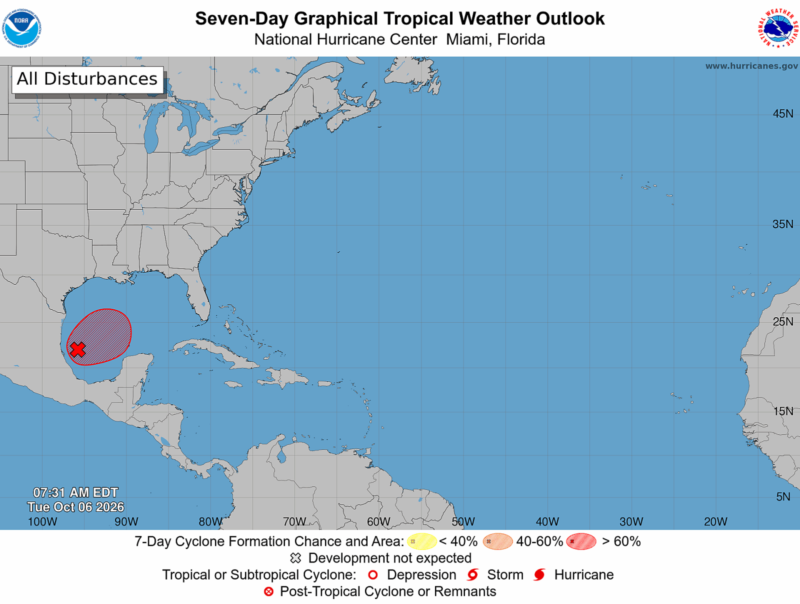
Formation of Tropical Storm Isaias Expected
A tropical disturbance in the Gulf of Mexico is anticipated to become Tropical Storm Isaias in the coming days. As the storm heads toward the United States, it may bring floods, storm surge, damaging winds, and isolated tornadoes to the Gulf Coast.
The National Hurricane Center has identified a high likelihood of tropical development from Invest 92L in the Bay of Campeche. To assess the storm’s potential strength and path, Hurricane Hunter aircraft are scheduled to investigate this disturbance.
Landfall Projections
Current spaghetti model guidance indicates potential landfall along the northern Gulf Coast, specifically between eastern Louisiana and the Florida Panhandle. These models show a growing consensus on this particular stretch of the coastline.
Meteorologist Matt Devitt stated the greatest potential for landfall extends from eastern Louisiana to the Florida Panhandle. AccuWeather’s Alex DaSilva adds that the confidence in the storm’s path toward the northern Gulf Coast is increasing.
Forecast Uncertainty Remains
While there remains some uncertainty about where the storm’s center will develop, projections place the highest risk along the Mississippi and Alabama coastlines. AccuWeather currently predicts landfall near Biloxi, Mississippi, on Saturday morning.
Further understanding of the storm’s timing and landfall location will depend on the formation of a better-defined center of circulation.
Tropical Storm Isaias’ Potential Strength
There is agreement that tropical development is likely, but the potential for Isaias to reach hurricane strength remains uncertain. Gulf water temperatures are warm enough to support the storm’s intensification. However, wind shear could influence its intensity.
Although AccuWeather anticipates the storm reaching hurricane strength on Friday, wind shear near the northern Gulf Coast might reduce its intensity before landfall.
Impact and Hazards
Regardless of Isaias reaching hurricane strength, water hazards pose a significant threat. Rainfall is expected to be heaviest east of the center, with forecasts estimating 1 to 4 inches of widespread rain and higher amounts in persistent bands.
Increased runoff from prior rainfall raises flooding risks. Additionally, onshore winds could prompt storm surge, leading to coastal flooding before the center arrives.
The storm’s path will affect areas beyond the Gulf Coast, with heavy rain possibly extending into the Ohio Valley and further east.
Wind gusts near landfall may range from 40-60 mph, potentially higher near the coast. These conditions may lead to power outages and property damage.
Tornadoes and storm surge are also anticipated. Tornadoes could occur at the eastern side of the storm’s center, and storm surge is expected near landfall.
National Hurricane Center’s Current Observations
The National Hurricane Center keeps studying Invest 92L, noting increased development odds as thunderstorms intensify. Hurricane Hunter missions will provide essential data on the storm’s characteristics.
If the disturbance develops a defined circulation and meets tropical-storm intensity criteria, it will be named Isaias, marking the ninth named storm of the Atlantic hurricane season.
Residents along the Gulf Coast are urged to review their hurricane preparedness plans and remain informed about local evacuation instructions.