
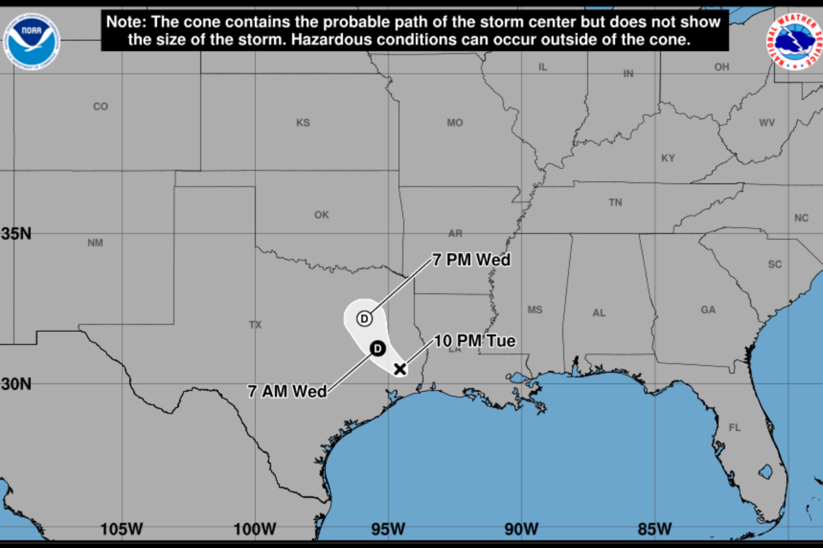
Tropical Storm Edouard is causing heavy rain, flooding concerns, and travel disruptions in Texas as it moves inland from the Gulf Coast. Although downgraded to a tropical depression, forecasters warn that the main threat comes from widespread rainfall capable of causing dangerous flash flooding.
The latest spaghetti models show Edouard tracking northward through eastern and central Texas. The heaviest rainfall corridor extends inland from the upper Texas coast. Despite the uncertainty about the storm’s exact path, models consistently indicate a broad impact zone from the Gulf Coast to eastern and central Texas, where the greatest flood risk is expected.
Edouard’s Shift From Wind to Rain Threat
The National Hurricane Center reports that while tropical storm force wind gusts near the storm’s center may occur, heavy rainfall is the main hazard. River and flash flooding are likely from the upper Texas coast into east-central Texas and southwestern Louisiana as the storm moves inland.
Texas Communities Brace for Flooding
Local officials in southeast Texas are preparing for the storm’s impact. Emergency managers in Montgomery County have mobilized equipment, coordinated with state partners, and secured additional resources such as rescue boats due to growing flooding concerns. School districts like Conroe ISD and Willis ISD canceled classes, and some government offices closed ahead of the storm.
Jason Millsaps, executive director of the Montgomery County Office of Homeland Security and Emergency Management, expressed concerns about heavy rain bands lingering over the area and causing significant rainfall in a short period. Officials have also set up barricades at flood-prone locations.
Flood Watches Span Large Parts of Texas
The National Weather Service issued Flood Watches covering regions of northeast, east-central, and southeast Texas. In Henderson County, and east-central counties like Anderson, Freestone, and Leon, rainfall between 1 and 3 inches is expected through Thursday night, with isolated totals reaching 4 to 6 inches. Excessive runoff may lead to flooding in low-lying areas.
Further south and east, a broader Flood Watch covers several counties, with rainfall totals of 3 to 6 inches forecast. Isolated locations may receive 10 to 15 inches of rain, especially along and east of Interstate 45. Rainfall rates might exceed 3 to 4 inches per hour during intense downpours.
What Happens Next?
Forecasters expect Edouard’s remnants to continue moving inland, spreading moderate to heavy rain across eastern Texas through Wednesday and Thursday. Even as the storm weakens, flood risks remain due to saturated areas receiving repeated rainfall rounds.
Emergency officials urge residents to monitor forecasts and heed flood warnings if conditions worsen. Drivers are strongly advised not to cross flooded roadways, as water depths can be deceiving and conditions can change quickly.
The office of Governor Greg Abbott responded to inquiries with an official statement addressing the state’s preparations for the tropical weather threat.
Key Takeaway
For many Texans, Edouard’s largest threat is no longer its winds but rather the flooding rainfall, which could inundate roads, neighborhoods, and waterways after the storm has weakened.