
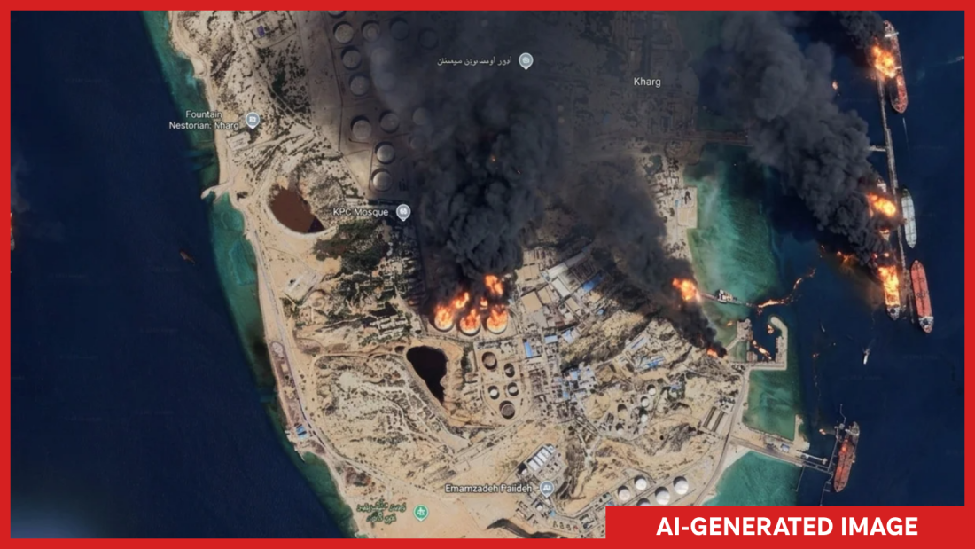
An AI-generated image displaying multiple fires on Kharg Island, an Iranian territory in the Persian Gulf with a strategic oil terminal, was created and annotated by NPR. The illustration was generated through a new feature introduced by Google Earth that enabled users to create AI-generated satellite images with a simple click. However, Google swiftly removed the tool after concerns arose over potential misuse.
Google stated on X, ‘We’ve seen geospatial professionals using this feature for various purposes. Still, we’ve witnessed people sharing screenshots of generated imagery that seemingly violate our policies. Therefore, we’re rolling back this feature while implementing stronger guardrails in the system.’
Initially, the company designed the tool to function creatively with users’ imaginations. Users could zoom into a location in Google Earth, select ‘create image,’ and type whatever they want to visualize. Bryan Horowitz, a product manager, had shared this capability upon the feature’s release.
However, experts reliant on Google’s imagery for verifying crucial events and atrocities quickly expressed horror at the potential for deepfake satellite images to be created effortlessly. Henk van Ess, an open-source researcher, reported generating images of dramatic scenes such as refugees at the Mexican border, a nuclear plant in Iran, and a hospital with a bomb crater in Gaza.
NPR successfully created images of Iran’s Kharg Island on fire and the U.S. Capitol complex flooded. Though fictitious, such events would have been major news if real. The revelation sparked conversations amongst online journalists and investigators about Google’s judgment. Evan Hill from the Washington Post pondered Google’s red team process, given the risks associated with misinformation.
Satellite imagery remains vital for distinguishing reality from deception amid AI-generated noise. Open-source investigators rely on such images to authenticate ground events and compare them against shared media. Google’s broad, high-resolution coverage provides essential references despite occasionally being outdated.
Jake Godin, a senior researcher with Bellingcat, emphasized the difficulty of fabricating satellite images due to institutional verification and the camera’s position miles above Earth’s surface. Yet, artificial fake images have emerged, such as during the U.S.-Israel conflict with Iran, where images purported to show a damaged U.S. base in Bahrain were fake.
The ability to easily generate AI satellite images could significantly speed up fake image production. Godin expressed concern that misinformation spreads faster than corrections, potentially leading to governments disputing real satellite images due to mistrust.
In a post on X, Google reiterated its commitment to countering misinformation. Images carry its SynthID watermark to identify AI generation across other tools like Gemini. The company also restricts image creation relating to harmful topics and continually updates protective measures.
Despite Google’s reassurances, skepticism persists within the open-source community. Van Ess reflected that the decision affected trust in Google Earth, traditionally esteemed for social media verification. If Google’s AI tool development continues, the validation of truth in imagery may be compromised.