
The Atlantic hurricane season runs from June 1 through November 30 each year. In 2026, the season is expected to be below average in terms of storm activity. The National Oceanic and Atmospheric Administration (NOAA) forecasts fewer storms than usual.
Here is a detailed timeline of storm activity recorded so far this year.
Active Storms
Currently, there are no active storms.
Previous Storms
Tropical Storm Arthur
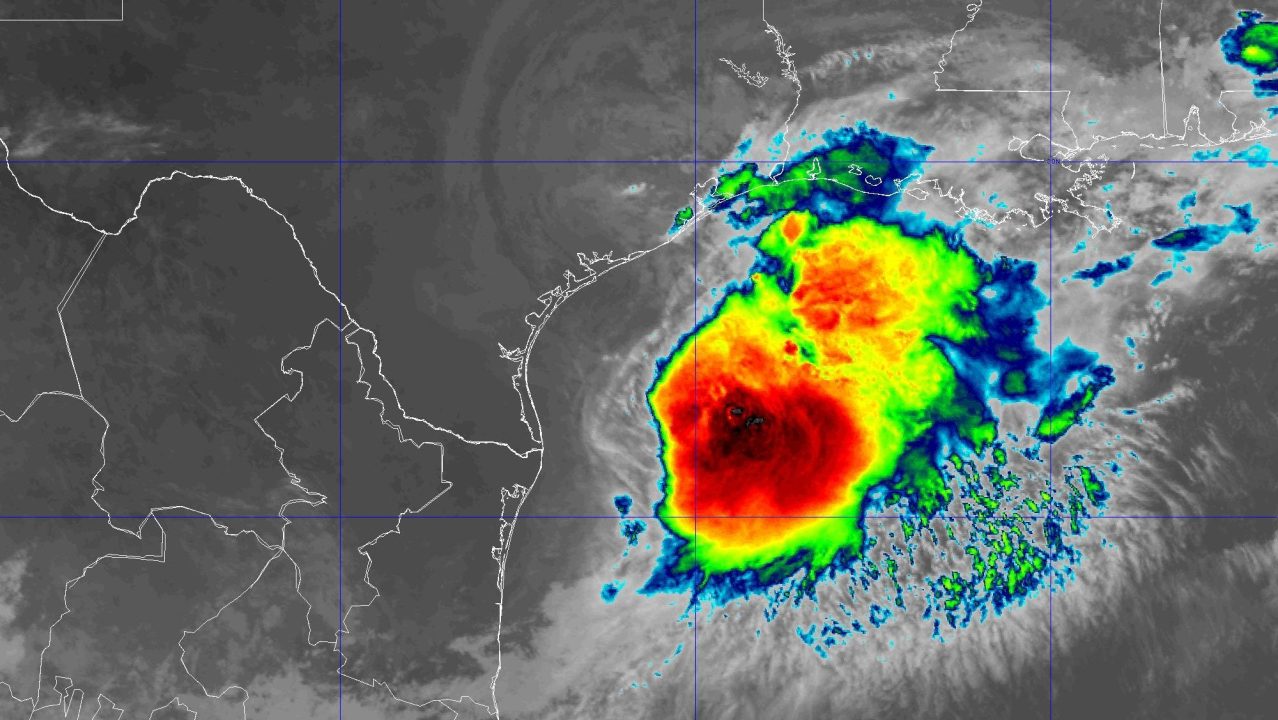
June 16, 10 a.m.: Potential Tropical Cyclone One was spotted about 65 miles southwest of Corpus Christi, Texas, with winds reaching 30 mph. It moved northeast at 6 mph.
June 17, 10 a.m.: Arthur turned into a tropical storm about 40 miles east-northeast of Port O’Connor, Texas. Winds increased to 40 mph, moving northeast at 9 mph.
June 17, 10 p.m.: Arthur transitioned to a post-tropical cyclone roughly 35 miles north-northeast of Galveston, Texas. Winds were sustained at 35 mph, continuing to move northeast at 9 mph.
Tropical Storm Bertha
July 19, 10 a.m.: Tropical Depression Two was formed 155 miles south of Panama City, Florida, with 30 mph winds moving north-northwest at 2 mph.
July 20, 7 p.m.: Strengthened into Tropical Storm Bertha, 110 miles south of Panama City, Florida, with winds reaching 40 mph.
July 22, 2 p.m.: Bertha moved ashore near St. Bernard Parish, Louisiana, with 45 mph winds moving west-northwest at 7 mph.
July 23, 10 p.m.: Bertha weakened to a tropical depression north-northeast of Houston, eventually dissipating west-northwest of Houston.
Tropical Storm Cristobal
August 12, 10 a.m.: Cristobal emerged 880 miles west of the Azores with 45 mph winds, heading east at 25 mph.
August 13, 10 a.m.: Cristobal weakened to a tropical depression about 535 miles west-northwest of the Azores. Speeds reduced to 35 mph.
Tropical Storm Dolly
August 27, 10 a.m.: Dolly formed 1,555 miles east of the Leeward Islands with 40 mph winds.
August 28, 10 a.m.: Dolly dissipated 1,000 miles east of the Leeward Islands.
Tropical Storm Edouard
August 31, 10 a.m.: Potential Tropical Cyclone Five appeared 130 miles south of Morgan City, Louisiana, with 35 mph winds.
September 1, 2:20 p.m.: Edouard made landfall near Johnson Bayou, Louisiana, boasting 60 mph winds.
September 3, 4 a.m.: Edouard dissipated southeast of Dallas.
Tropical Depression Fay
September 19, 10 a.m.: Tropical Depression Six surfaced 525 miles southwest of the Azores. Winds peaked at 35 mph.
September 23, 10 p.m.: Fay redevelops into a tropical storm 935 miles west-southwest of the Azores, with winds at 40 mph.
September 29, 4 p.m.: Fay dissipated west-southwest of the Azores.
Tropical Storm Gonzalo
September 24, 10 p.m.: Gonzalo developed 190 miles southeast of Cabo Verde islands. Wind speeds reached 45 mph.
September 26, 4 p.m.: Gonzalo dissipated north of Sal, Cabo Verde.
Tropical Storm Hanna
September 28, 10 a.m.: Hanna formed east-northeast of Bermuda. It had winds of 45 mph.
September 30, 10 a.m.: Hanna ceased east of Bermuda.
Hurricane Isaias
October 6, 4 p.m.: Tropical Depression Nine took shape 380 miles west of Progreso, Mexico, reaching 35 mph winds.
October 9, 7:20 a.m.: Isaias intensified into a Category 3 hurricane south of Pensacola, Florida. Wind speeds hit 120 mph.
October 10, 4 a.m.: Isaias transitioned to a post-tropical cyclone south-southwest of Montgomery, Alabama, with 35 mph winds.