
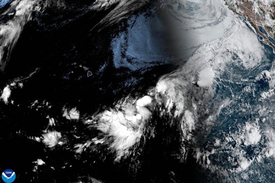
Tropical Storm Hernan has emerged in the Pacific Ocean, remaining far from land. The National Hurricane Center reports Hernan positioned approximately 1,460 miles west of the southern tip of Mexico’s Baja California peninsula. The storm exhibits maximum sustained winds of about 40 mph and continues its westward trajectory.
In contrast, forecasters are closely monitoring another system, designated Potential Tropical Cyclone One-C, situated roughly 775 miles east-southeast of Hawaii. Although not yet a tropical storm, this system may escalate, bringing significant weather impacts to the Hawaiian Islands over the weekend.
The system, currently with winds of 40 mph, lacks the organization required to be classified as a tropical storm. However, predictions indicate a potential landfall as a tropical storm on the Big Island’s southern region by Saturday.
Expected weather developments in the Hawaiian Islands could result in substantial rainfall amounts. Forecasters predict rainfall ranging from 5 to 10 inches, with isolated areas potentially experiencing up to 20 inches. This could lead to flooding and mudslides.
In the Atlantic, Tropical Storm Cristobal has diminished to a tropical depression and is anticipated to dissipate soon. Positioned about 610 miles west of the Azores, it poses no threat to land.